The 5 best Waterline forts near Utrecht, ranked
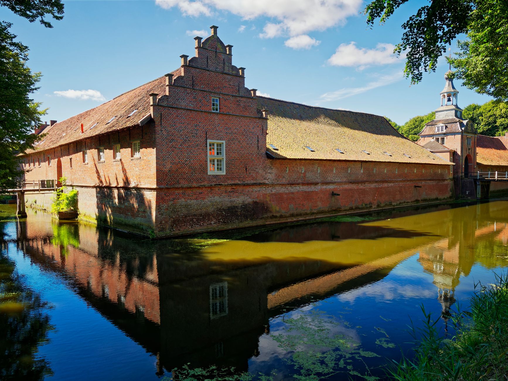 Grass-covered brick fort with a moat in the flat countryside east of Utrecht
Utrecht sits in the middle of the Nieuwe Hollandse Waterlinie, a UNESCO-listed defence line of some 46 forts and works — here are the 5 within cycling distance that are genuinely worth a half-day.
How this ranking works
The Nieuwe Hollandse Waterlinie ran roughly 85 kilometres from Muiden to the Biesbosch, and its logic was water rather than walls: sluices flooded the fields to about knee depth, too deep to march through and too shallow to row across. Forts guarded the dry gaps — the roads, dykes and railway lines. The line was added to the UNESCO World Heritage list in 2021 as an extension of the Defence Line of Amsterdam, which pushed money into restoration and signage. Utrecht sits dead centre, so a bike and a day gets you to more of it than any other Dutch city.
I ranked these five on three things: can you actually get inside, does the site explain the flooding system rather than just look pretty, and can you reach it from Utrecht Centraal in under an hour by bike or bike-plus-train. That knocks out several handsome forts now leased as private event venues, where the closest you get is the car park gate. Expect entry in the €0-17 band, expect several sites to open Tuesday to Sunday only, and expect winter closures for bat hibernation. Always check the operator's own page for the week you are going.
1. Fort Vechten, Bunnik — the one that explains the whole line
Fort Vechten is the biggest single reason the Waterline makes sense to a visitor. It covers about 17 hectares on the Marsdijk outside Bunnik, and the Waterliniemuseum, buried into the ramparts since 2015, is the only place that lays out the inundation system properly: sluices, dammed roads, sightlines, the ugly compromises of a defence that depended on ditches. Outside sits a walk-in relief map of the whole line, big enough that children run the length of Holland in a minute. Budget two to three hours and expect an adult ticket somewhere in the €13-17 range.
Get there by bike: leave Utrecht via Amelisweerd and follow the Kromme Rijn, about 8-9 kilometres of near-traffic-free path, and you arrive having crossed the exact landscape the fort defended. By train, Bunnik station is roughly 2 kilometres away — pleasant on foot, better on an OV-fiets from Utrecht Centraal. The catch is popularity: on a warm Sunday the museum and its café fill with families, and the relief map becomes a paddling pool. Go on a weekday morning if you want the earthworks and the bomb-proof barracks to yourself, and combine with Rijnauwen next door.
2. Fort bij Rijnauwen — the biggest, and only by guided tour
Rijnauwen is the largest fort on the whole line, roughly 40 hectares of earth, brick and mature woodland between Bunnik and the Amelisweerd estates. It is managed as a nature reserve because the casemates are a nationally important bat roost, so you can only go in on a guided walk, booked in advance, usually two hours and priced in the €10-15 band. That restriction is the reason it ranks so high: nothing else on the line feels this abandoned to nature, with trees growing out of gun emplacements and frogs where the garrison drilled.
Tours also cover the darker layer. During the Second World War the Germans used the fort as an execution site, and there is a memorial in the grounds; guides handle it plainly rather than sentimentally. Practicalities: check the season and language of the tour before booking, since not every walk runs in English, and wear boots — the paths hold water for days after rain. Pair it with lunch at the pancake house at Rhijnauwen, five minutes away, and you have the best single day out in this list for around €25 a head including food.
3. Fort Honswijk, Tull en 't Waal — the river fort with the big horizon
Honswijk was built in the 1840s where the line meets the Lek, and it is the most dramatic setting of the five: a round tower fort behind a dyke, with the river running wide and grey beside it and cargo ships passing at eye level. Restoration work over recent years reopened much of the grounds, and the neighbouring works — Werk aan de Korte Uitweg among them — make a 4-kilometre walking loop of earthworks, orchards and dyke. Opening is more limited and more event-driven than Vechten, so treat the operator's calendar as the deciding factor.
It is about 20 kilometres from the centre of Utrecht, best reached via Houten, whose bicycle-first street plan makes the ride genuinely fast, or by train to Houten Castellum and 8 kilometres of dyke path. Seasonal bicycle ferries cross the Lek near here, which turns the trip into a loop rather than an out-and-back — check the ferry's operating season before you commit, because they stop in winter and in high water. Bring your own food: catering at the fort is intermittent, and the nearest reliable terrace is back in Tull en 't Waal or Houten.
4. Fort Everdingen, near Vianen — the one with the brewery
Everdingen guards the point where the line crosses the Lek on the south side, and it has been given the most enjoyable second life on this list: an independent brewery occupies the bomb-proof barracks, with a taproom under two-metre-thick brick and a terrace on the grass ramparts. You can walk the moat path free, then drink beer brewed 30 metres from where you are sitting, with pints and tasting flights in the usual Dutch €5-9 range. Taproom hours skew to Thursday-Sunday afternoons, so a midweek morning visit gets you locked gates and a nice walk.
The ride out is 25-27 kilometres from Utrecht, most of it along the Merwedekanaal and then the Lek dyke, and the return leg into a west wind is the real cost of the day. Cheat it: train to Culemborg or take the bus towards Vianen and ride one direction only. This is the pick if you want a fort visit that ends socially rather than educationally — there is little interpretation on site, so read up at Vechten first if you want to understand what the earth banks around you were for.
5. Fort Blauwkapel — a fortified village you can walk in 20 minutes
Blauwkapel is unlike anything else here: a whole hamlet, church and all, sealed inside a ring of ramparts on the north-east edge of Utrecht. The village church has medieval bones, the earthworks are grassed and freely walkable, and the whole circuit takes twenty minutes. It costs nothing, needs no booking, and sits about 6 kilometres from the Dom by bike — a good early-evening ride when the light goes long over the moat. It ranks fifth only because there is no museum, no guide and nothing to enter beyond the church on open days.
The honest catch is noise: motorway and ring-road traffic runs close, so the atmosphere is more curiosity than idyll. Pair it with Fort de Gagel or Fort aan de Klop on the Vecht to the north-west, where a café and terrace make a better stop, and skip Fort Voordorp entirely unless you have a wedding invitation — it operates as a private events venue. If you only have one afternoon, do not spend it here: ride to Vechten instead and keep Blauwkapel for a summer evening when you want 12 kilometres of round trip and a beer at the end.
Planning a fort day: costs, kit and what to skip
A realistic Waterline day from Utrecht: rent a bike at Utrecht Centraal (station rental including OV-fiets is the cheap option, roughly €5-10 for 24 hours — confirm the current tariff with the operator), spend €13-17 on the Waterliniemuseum, €10-15 on a Rijnauwen tour if it is running, and €15-20 on pancakes or fort-brewery beer. Under €60 all in for two people plus bikes is normal. Navigate with the national junction network (the numbered fietsknooppunten) rather than a phone map; the Waterliniepad walking route and the signed cycle route along the line both use it.
What to skip: the forts marketed purely as conference centres, and any plan that tries to hit four forts in one day — they are 10-25 kilometres apart and the pleasure is in the flat ride between them, not the ticking off. Skip winter for the interiors, since bat protection closes casemates from roughly late autumn to early spring; go instead in May-June for wildflowers on the ramparts or September for empty paths. And do not drive: parking at several of these sites is small, paid and much further from the entrance than you expect.
Before you book
The questions people ask about Utrecht, answered with this month’s numbers.
Yes. The interior is only accessible on guided walks, which have limited places and do not run every day or in every language. Book through the site manager's own booking page well ahead for weekends, and check whether your date falls inside the bat-protection closure period for the casemates.
Fort Vechten at Bunnik. The walk-in relief map of the whole defence line is effectively a giant water table, the tunnels are lit and safe, and the café and grass make a picnic easy. The 9-kilometre ride out along the Kromme Rijn is flat and almost entirely off-road.
No single ticket covers the line. Each site sells its own admission, and several forts are free to walk around outside. If you plan multiple visits across a year, check whether nature-organisation or museum membership schemes cover parking and entry at the specific forts you want.
Partly. Bunnik, Houten Castellum and Culemborg stations put you within 2-8 kilometres of Vechten, Honswijk and Everdingen, and regional buses serve Bunnik and Vianen. But the walks in are long and the fort-to-fort gaps are 10-25 kilometres, so a bike from Utrecht Centraal roughly doubles what you see in a day.